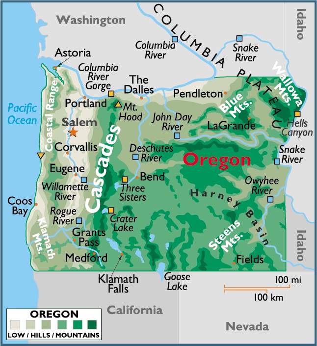
Map of Oregon, USA
Capital City: Salem
Location: 44º 57′ N, 123º 02′ W
Popular City: Bend
Location: 44º 03′ N, 121º 18′ W
Oregon geographical area and extent:
Located on the Pacific coast of the northwestern US. Oregon ranks 10th in size among the 50 states.
The total area of Oregon is 97,073 sq mi (251,419 sq km), with land comprising 96,184 sq mi (249,117 sq km) and inland water 889 sq mi (2,302 sq km). Oregon extends 395 mi (636 km) E-W; the state’s maximum N-S extension is 295 mi (475 km).
Oregon is bordered on the N by Washington (with most of the line formed by the Columbia River); on the E by Idaho (with part of the line defined by the Snake River); on the S by Nevada and California; and on the W by the Pacific Ocean. The total boundary length of Oregon is 1,444 mi (2,324 km), including a general coastline of 296 mi (476 km); the tidal shoreline extends 1,410 mi (2,269 km). The state’s geographic center is in Crook County, 25 mi (40 km) SSE of Prineville.

You must be logged in to post a comment.