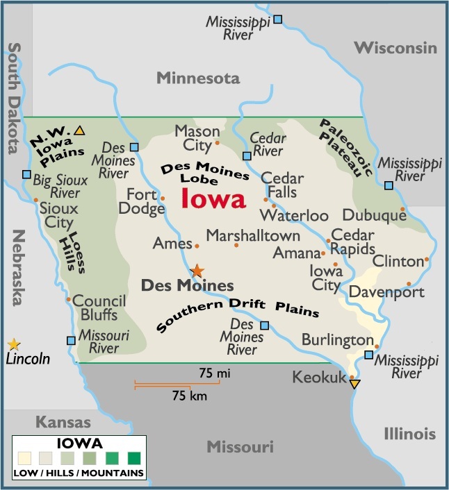
Map of Iowa
Iowa is positioned in both the northern and western hemispheres. Located in the North Central (or Midwest Region) of the United States of America – a part of North America – Iowa is bordered by the states of Minnesota, Wisconsin, Illinois, Missouri, Nebraska and South Dakota.
Capital City: Des Moines
Location: 41º 36′ N, 93º 36′ W
COmmercial City: Cedar Rapids
Location: 42º 00′ N, 91º 38′ W

You must be logged in to post a comment.