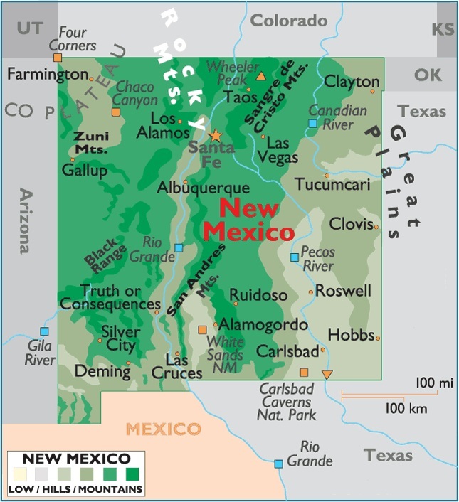
Map of New Mexico, USA
Capital City: Santa Fe
Location: 35º 41′ N, 105º 56′ W
Largest City: Albuquerque
Location: 35º 05′ N, 106º 39′ W
New Mexico geographical area and extent:
New Mexico is located in the southwestern US. Smaller only than Montana of the eight Rocky Mountain states, it ranks 5th in size among the 50 states. The area of New Mexico is 121,593 sq mi (314,926 sq km), of which land comprises 121,335 sq mi (314,258 sq km) and inland water 258 sq mi (668 sq km). Almost square in shape except for its jagged southern border, New Mexico extends about 352 mi (566 km) E-W and 391 mi (629 km) N-S.
New Mexico is bordered on the N by Colorado; on the E by Oklahoma and Texas; on the S by Texas and the Mexican state of Chihuahua (with a small portion of the south-central border formed by the Rio Grande); and on the W by Arizona. The total boundary length of New Mexico is 1,434 mi (2,308 km).
The geographic center of the state is in Torrance County, 12 mi (19 km) SSW of Willard.


You must be logged in to post a comment.