 Louisiana is located in the Gulf Coast region of the United States of America – a part of North America – Louisiana is bordered by the states of Arkansas, Mississippi and Texas and the Gulf of Mexico.
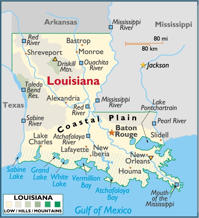
Situated in the western south-central US, Louisiana ranks 31st in size among the 50 states. The total area of Louisiana is 47,751 sq mi (123,675 sq km), including 44,521 sq mi (115,309 sq km) of land and 3,230 sq mi (8,366 sq km) of inland water. The state extends 237 mi (381 km) E-W; its maximum N-S extension is 236 mi (380 km). Louisiana is shaped roughly like a boot, with the heel in the SW corner and the toe at the extreme SE.
Louisiana is bordered on the N by Arkansas; on the E by Mississippi (with part of the line formed by the Mississippi River and part, in the extreme SE, by the Pearl River); on the S by the Gulf of Mexico; and on the W by Texas (with part of the line passing through the Sabine River and Toledo Bend Reservoir). The state’s geographic center is in Avoyelles Parish, 3 mi (5 km) SE of Marksville. The total boundary length of Louisiana is 1,486 mi (2,391 km). Louisiana’s total tidal shoreline is 7,721 mi (12,426 km).
Capital City: Baton Rouge
Location: 30º 27′ N, 091º 09′ W
Commercial City: New Orleans
Location: 29º 57′ N, 090º 04′ W


You must be logged in to post a comment.