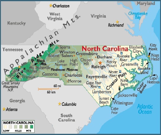
Map of North Carolina, USA
North Carolina is located in the eastern region of the United States, a part of North America. North Carolina is bordered by the states of South Carolina, Georgia, Tennessee and Virginia, and by the Atlantic Ocean.
Capital City: Raleigh
Location: 35º 46′ N, 78º 38′ W
Commercial City: Asheville
Location: 35º 36′ N, 82º 33′ W
Popular City: Wilmington
Location: 34º 13′ N, 77º 56′ W
North Carolina geographical area and extent:
Located in the southeastern US, North Carolina ranks 28th in size among the 50 states.
The total area of North Carolina is 52,669 sq mi (136,413 sq km), of which land accounts for 48,843 sq mi (126,504 sq km) and inland water 3,826 sq mi (9,909 sq km). North Carolina extends 503 mi (810 km) E-W; the state’s maximum N-S extension is 187 mi (301 km).
North Carolina is bordered on the N by Virginia; on the E by the Atlantic Ocean; on the S by South Carolina and Georgia; and on the W by Tennessee. A long chain of islands or sand banks, called the Outer Banks, lies off the state’s Atlantic coast. The total boundary line of North Carolina is 1,270 mi (2,044 km), including a general coastline of 301 mi (484 km); the tidal shoreline extends 3,375 mi (5,432 km). The state’s geographic center is in Chatham County, 10 mi (16 km) NW of Sanford.

You must be logged in to post a comment.