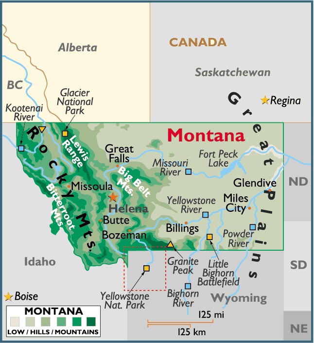
Map of Montana, USA
Capital City: Helena
Location: 46º 35′ N, 112º 02′ W
Largest City: Billings
Location: 45º 47′ N, 108º 30′ W
The total area of Montana is 147,046 sq mi (380,849 sq km), of which land takes up 145,388 sq mi (376,555 sq km) and inland water 1,658 sq mi (4,294 sq km). The state’s maximum E-W extension is 570 mi (917 km); its extreme N-S distance is 315 mi (507 km).
Montana is bordered on the N by the Canadian provinces of British Columbia, Alberta, and Saskatchewan; on the E by North Dakota and South Dakota; on the S by Wyoming and Idaho; and on the W by Idaho. The total boundary length of Montana is 1,947 mi (3,133 km). The state’s geographic center is in Fergus County, 12 mi (19 km) W of Lewistown. Nearly 30% of the state’s land belongs to the federal government.


You must be logged in to post a comment.