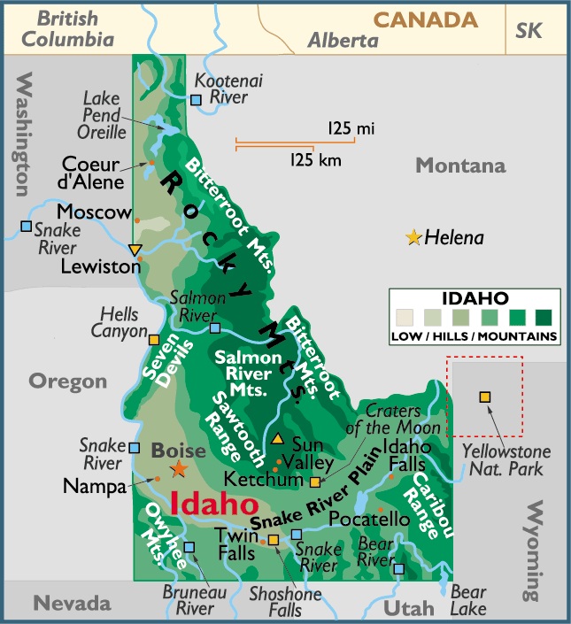
Map of Idaho
Idaho is positioned in both the northern and western hemispheres. Located in the west central region (or Mountain States area) of the United States of America – a part of North America – Idaho is bordered by the states of Montana, Wyoming, Utah, Nevada, Oregon Washington and by the Canadian Province of British Columbia.
Coeur d’Alene is the largest city and county seat of Kootenai County, Idaho, United States. It is the principal city of the Coeur d’Alene Metropolitan Statistical Area. Coeur d’Alene has the second largest metropolitan area in the state of Idaho.
Capital City: Boise
Location: 43º 37′ N, 116º12′ W
Commercial City: Coeur d’Alene
Location: 47º 41′ N, 116º 47′ W


You must be logged in to post a comment.