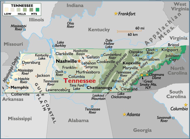
Map of Tennessee, USA
Capital city: Nashville
Location: 36º 17′ N, 86º 77′ W
Commercial cities:
Bristol
Location: 36º 59′ N, 82º 21′ W
Memphis
Location: 35º 15′ N, 90º 04′ W
Geographical area and extent:
Situated in the eastern south-central US, Tennessee ranks 34th in size among the 50 states.
The total area of the state is 42,144 sq mi (109,152 sq km), of which land occupies 41,155 sq mi (106,591 sq km) and inland water 989 sq mi (2,561 sq km). Tennessee extends about 430 mi (690 km) E-W and 110 mi (180 km) N-S.
Tennessee is bordered on the N by Kentucky and Virginia; on the E by North Carolina; on the S by Georgia, Alabama, and Mississippi; and on the W by Arkansas and Missouri (with the line formed by the Mississippi River). The boundary length of Tennessee totals 1,306 mi (2,102 km). The state’s geographic center lies in Rutherford County, 5 mi (8 km) NE of Murfreesboro.

You must be logged in to post a comment.