Map of Mississippi, USA
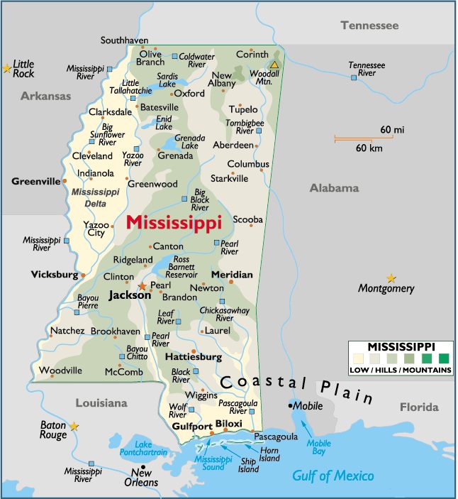
Capital City: Jackson
Location: 32º 17′ N, 90º 11′ W
Capital City: Meridian
Location: 32º 36′ N, 88º 70′ W
The total area of Mississippi is 47,689 sq mi (76,779.29 sq km), of which land takes up 47,233 sq mi (76,045.13 sq km) and inland water 456 sq mi (734.16 sq km). Mississippi’s maximum E-W extension is 188 mi (302.68 km); its greatest N-S distance is 352 mi (566.72 km).
Mississippi is bordered on the N by Tennessee; on the E by Alabama; on the S by the Gulf of Mexico and Louisiana; and on the W by Louisiana (with the line partially formed by the Pearl and Mississippi rivers) and Arkansas (with the line formed by the Mississippi River). Several small islands lie off the coast.
The total boundary length of Mississippi is 1,015 mi (1,634 km). The state’s geographic center is in Leake County, 9 mi (14.49 km) WNW of Carthage.


You must be logged in to post a comment.