Map of Maine, USA
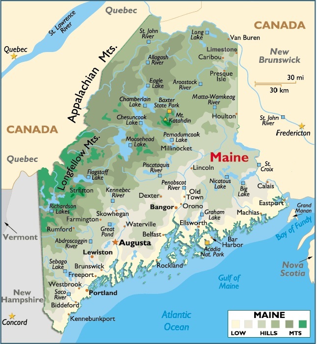
Maine is located in the northeastern region of the United States (one often referred to as New England), Maine is bordered by the Atlantic Ocean, State of New Hampshire, and the Canadian provinces of New Brunswick and Quebec.
The total area of Maine is 33,265 sq mi (86,156.35 sq km), including 30,995 sq mi (80,277.05 sq km) of land and 2,270 sq mi (5879.3 sq km) of inland water. Maine extends 207 mi (333 km) E-W; the maximum N-S extension is 322 mi (518.42 km).
Maine is bordered on the N by the Canadian provinces of Quebec (with the line passing through the St. Francis River) and New Brunswick (with the boundary formed by the St. John River); on the E by New Brunswick (with the lower eastern boundary formed by the Chiputneticook Lakes and the St. Croix River); on the SE and S by the Atlantic Ocean; and on the W by New Hampshire (with the line passing through the Piscataqua and Salmon Falls rivers in the SW) and Quebec.
Hundreds of islands dot Maine’s coast. The largest is Mt. Desert Island; others include Deer Isle, Vinalhaven, and Isle au Haut. The total boundary length of Maine is 883 mi (1,421 km).
The state’s geographic center is in Piscataquis County, 18 mi (29 km) N of Dover-Foxcroft. The easternmost point of the US is West Quoddy Head, at 66°57’w.
Capital City: Augusta
Location: 44º 32′ N, 69º 76′ W
Popular City: Presque Isle
Location: 46º 68′ N, 68º 01′ W


You must be logged in to post a comment.