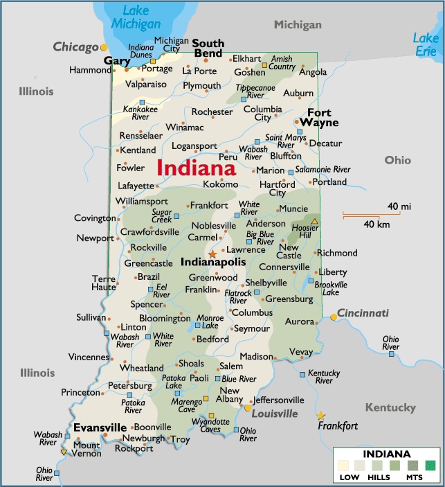
Map of Indiana
Indiana is located in Central Eastern region of North America.
It’s bordered by the following states from its North moving clockwise is Michigan, Ohio, Kentucky, Illinois and Lake Michigan.
Capital City: Indianapolis
Location: 39º 76′ N, 86º 14′ W
Popular City: Gary
Location: 41º 61′ N, 87º 34′ W


You must be logged in to post a comment.