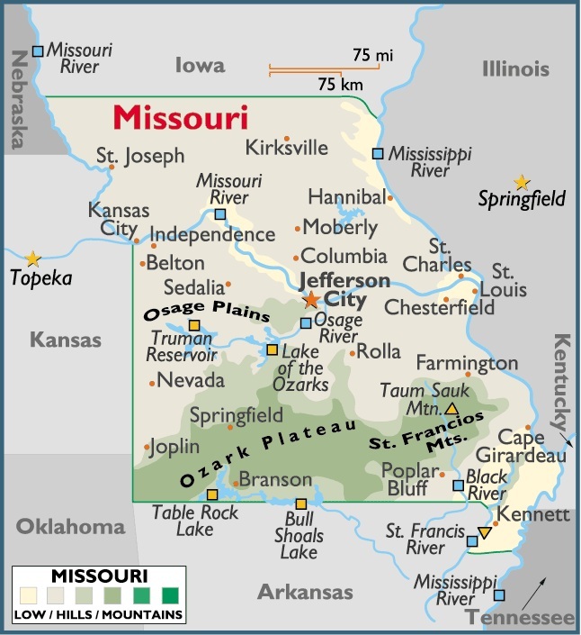
Map of Missouri, USA
Capital City: Jefferson City
Location: 38º 34′ N, 92º 10′ W
Largest City: St. Louis
Location: 38º 37′ N, 90º 11′ W
The total area of Missouri is 69,697 sq mi (180,516 sq km), of which land takes up 68,945 sq mi (178,568 sq km) and inland water 752 sq mi (1,948 sq km). Missouri extends 284 mi (457 km) E-W; its greatest N-S extension is 308 mi (496 km).
Missouri is bounded on the N by Iowa (with the line in the extreme NE defined by the Des Moines River); on the E by Illinois, Kentucky, and Tennessee (with the line passing through the Mississippi River); on the S by Arkansas (with a “boot heel” in the SE bounded by the Mississippi and St. Francis rivers); and on the W by Oklahoma, Kansas, and Nebraska (the line in the NW being formed by the Missouri River).
The total boundary length of Missouri is 1,438 mi (2,314 km). The state’s geographic center is in Miller County, 20 mi (32 km) SW of Jefferson City.


You must be logged in to post a comment.